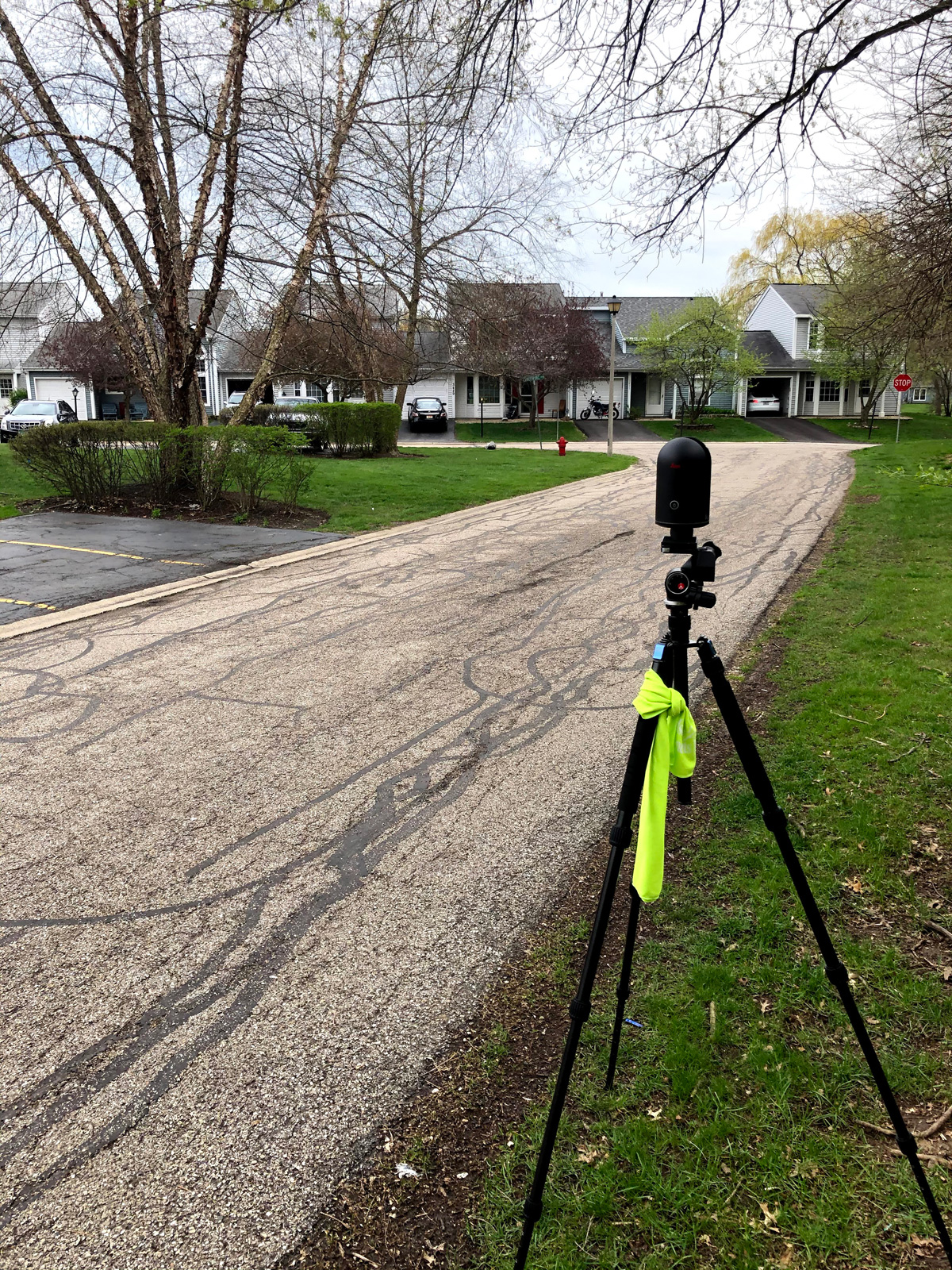
Technology has been advancing rapidly in the 21st century specifically in the areas of data capture and digital imaging. Gone are the days of tape measures as we’re seeing the advent of measuring systems like Light Detection and Ranging (LiDAR). In the time an engineer would take to measure a room, camera systems like the Leica BLK360 can measure entire properties to better than ¼”.
Having information recorded digitally means more information and more detail; in other words, quantity and quality. More information allows us to make more informed decisions and offer more economical and intelligent solutions to our clients. This new technology improves our current inspection offerings and offers associations a multitude of other benefits. There are two main benefits to you:
1) WEC spends less time in the field making measurements and calculations AND less time preparing drawings. We no longer need to go back onsite to gather more measurements or data, we have all that digitally stored after just one site visit. 2) This device minimizes human error. There are infinite possibilities for error when performing measurements by hand either when performing the measurement or recording the data; utilizing a digital system removes many of those opportunities
Façade & Roof Evaluations
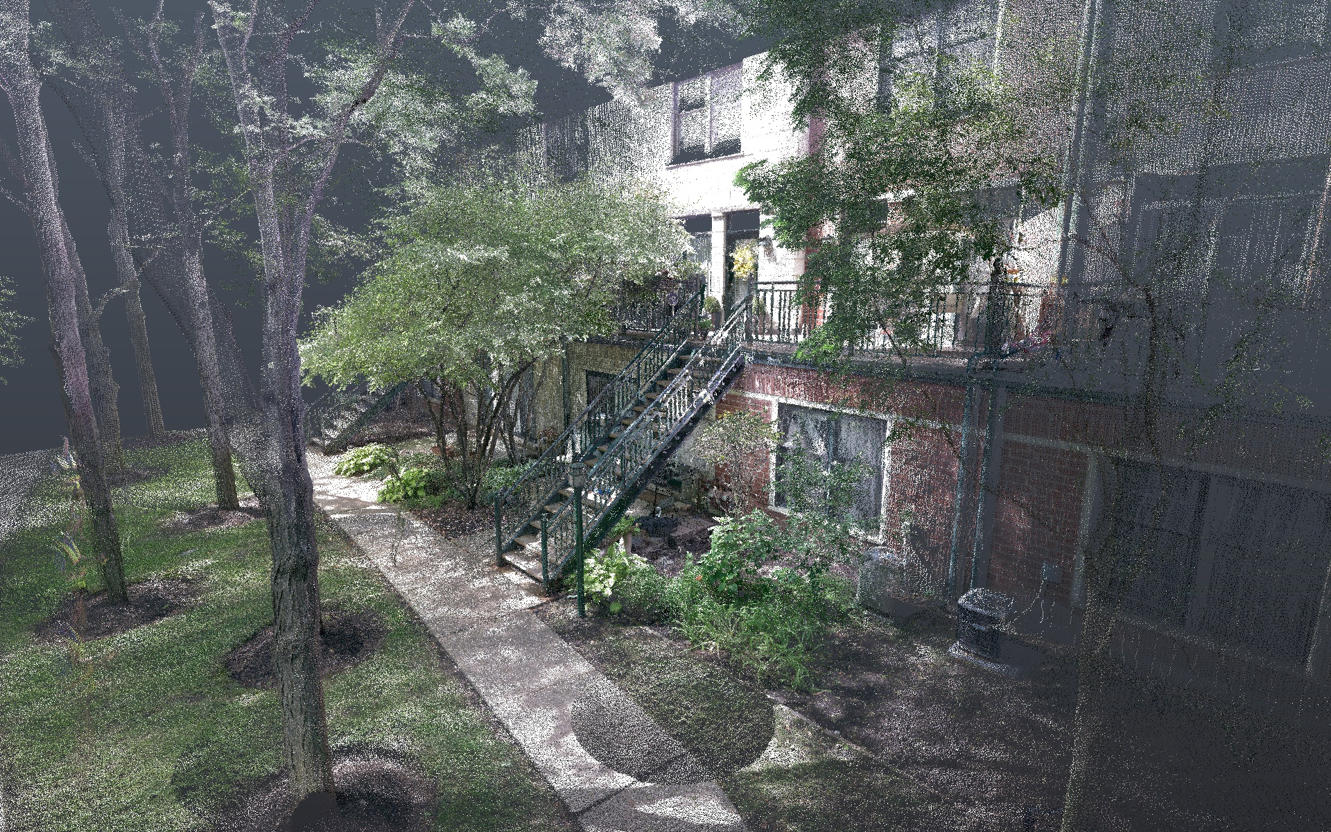
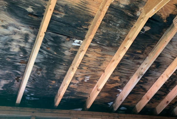
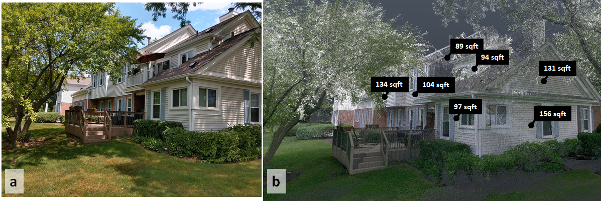
For example, conducting a scan of a building envelope for a façade or roof replacement can quickly tell us the amount of materials needed. Additionally, that scan can later be used to derive information regarding entry ways, windows, drainage, and many other items. This means we can spend less time measuring for current and future projects. Take this image captured by the Leica BLK360, a standard image we’d get from scanning a building’s envelope. We can already use this scan to calculate window and façade dimensions. Through further processing we can even isolate certain elements. Perhaps the association also decides they want to repair the stairwells, we can conduct analysis and measurements on that element.
We can remove the surrounding foliage and handrails to analyze each individual step seen in image 2.
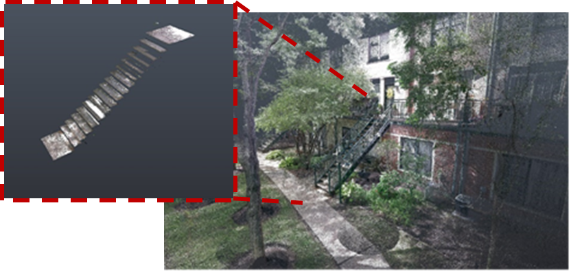
We can use these images to make very detailed analyses of the steps: height, depth, displacement, etc. Image 3 shows the capabilities of taking a scan and converting that information into usable square footage for siding replacement. Additionally, all these measurements can be transformed into drawings for the property—more important to you than mountains of raw data. So, whether you’re looking to replace 300 roofs or thousands of square feet of facade in your association, this tool is the most efficient means of putting together specifications for that project.
Pavement & Drainage Evaluations
The precise measurements of the BLK 360 can be effectively used to topographically map an area. Having a visual representation of an area’s terrain is essential in developing a plan to improve drainage issues in an association. We measured thousands of feet of this association’s pavement to within a ¼”.
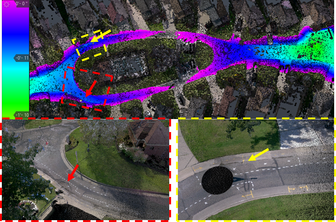
The above scan tells us the areas in blue and purple represent the lowest areas in the association. When juxtaposed with the marked areas of degradation in the pavement, it is apparent where the ponding water lies—these are the areas that need to be replaced or repaired.
Conclusion
Do you have big capital improvement projects coming up? Allow WEC to provide you with better, more detailed information in a more efficient manner. Ask us how we can utilize the BLK360 at your property.